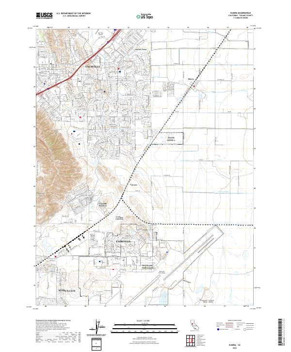
2022 Map of Elmira
USGS Topo · Published 2022About this map
Vacaville and Fairfield anchor this modern survey of eastern Solano County, where the sprawling suburban developments of Leisure Town and the northern outskirts of Suisun City meet the agricultural expanse of the Sacramento Valley. The landscape is defined by its transit and military corridors, with I-80 and I-505 carving through the terrain near the English Hills and Vaca Valley. A significant portion of the sheet is occupied by the operational footprint of Travis Air Force Base, while regional infrastructure is highlighted by Nut Tree Airport and the rail alignments of the Calif Pacific Rd. Between the growing city centers, smaller historic points like Cannon, Vacaville Junction, and Elmira persist alongside vital drainage systems such as Ulatis Cr and Barker Slough, which feed toward the Central Valley wetlands. This map captures the intensive 21st-century residential expansion and strategic infrastructure that characterizes this portion of the North Bay subregion.
Find a feature on this map
36 named features on this map. Tap any name to fly to it.
Don’t see what you’re looking for? This feature index may not catch every label — zoom into the map to look around manually.
Map Details
Editions of this 2022 Elmira Map
This is the sole edition of this map. No revisions or reprints were ever made.
Other maps of this area

1896 · Carquinez Strait
USGS Topo · 1:62,500

1898 · Karquines
USGS Topo · 1:62,500

1901 · Karquines
USGS Topo · 1:62,500

1902 · Napa
USGS Topo · 1:125,000

1907 · Antioch
USGS Topo · 1:62,500

1908 · Vacaville
USGS Topo · 1:62,500

1908 · Antioch
USGS Topo · 1:62,500

1916 · Dixon
USGS Topo · 1:31,680

1916 · Maine Prairie
USGS Topo · 1:31,680

1917 · Wolfskill
USGS Topo · 1:31,680