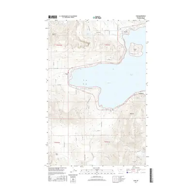
2017 Map of Elmo
USGS Topo · Published 2017About this map
Flathead Lake dominates the eastern half of this landscape, its waters reaching into the large western bay known as Big Arm. Along the northern shores, the communities of Dayton and Elmo serve as focal points for local navigation and transport, while the smaller settlement of Lindisfarne occupies the southeastern shoreline. The terrain rises sharply away from the water, most notably at the striking Chief Cliff and the higher elevations of the Hog Heaven Range to the northwest.
Find a feature on this map
56 named features on this map. Tap any name to fly to it.
Don’t see what you’re looking for? This feature index may not catch every label — zoom into the map to look around manually.
Map Details
Editions of this 2017 Elmo Map
This is the sole edition of this map. No revisions or reprints were ever made.
Other maps of this area

1920 · Flathead Lake
USGS Topo · 1:125,000

1956 · Wallace
USGS Topo · 1:250,000

1960 · Wallace
USGS Topo · 1:250,000

1964 · Buffalo Bridge
USGS Topo · 1:24,000

1964 · Wild Horse Island
USGS Topo · 1:24,000

1964 · Irvine Lookout Tower
USGS Topo · 1:24,000
1964 · Lake Mary Ronan
USGS Topo · 1:24,000
1964 · Rollins
USGS Topo · 1:24,000

1964 · Elmo
USGS Topo · 1:24,000

1964 · Polson
USGS Topo · 1:24,000