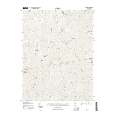
2016 Map of Elmwood
USGS Topo · Published 2016About this map
Tribble and Elmwood anchor this 2016 survey of the undulating hills where Mason, Jackson, and Putnam counties converge. The landscape is defined by its deep drainages and named ridges, illustrating a rural settlement pattern where life follows the high ground of Manila Ridge and Jim Ridge. For genealogists, the map is particularly valuable for its density of small burial grounds and country churches, ranging from Mount Prospect Cem near the center of the sheet to the Long Hollow Baptist Church in the north. The area's nomenclature is remarkably descriptive of its topography and local character, featuring evocative place names like Tightsqueeze Hollow, Coal Hollow, and Frog Hollow. This modern data preserves the locations of established landmarks such as Walker Chapel Cem and Barnette Chapel alongside the winding county route network that has served these ridge-top communities for generations.
Find a feature on this map
111 named features on this map. Tap any name to fly to it.
Don’t see what you’re looking for? This feature index may not catch every label — zoom into the map to look around manually.
Map Details
Editions of this 2016 Elmwood Map
This is the sole edition of this map. No revisions or reprints were ever made.
Other maps of this area

1906 · Kenna
USGS Topo · 1:62,500

1906 · Winfield
USGS Topo · 1:62,500

1907 · Kenna
USGS Topo · 1:62,500

1907 · Ripley
USGS Topo · 1:62,500

1908 · Winfield
USGS Topo · 1:62,500

1908 · Ravenswood
USGS Topo · 1:62,500

1926 · Ravenswood
USGS Topo · 1:62,500

1926 · Ripley
USGS Topo · 1:62,500

1928 · Ravenswood
USGS Topo · 1:62,500

1928 · Ripley
USGS Topo · 1:62,500