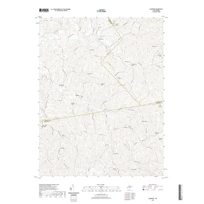
2019 Map of Elmwood
USGS Topo · Published 2019About this map
Elmwood and Tribble anchor this landscape where the boundaries of Mason, Jackson, and Putnam Counties converge. The terrain is defined by a dense network of ridges and hollows, including Cain Ridge and Brotherton Ridge, which dictate the winding paths of rural routes like Gunnville Ridge Rd and Manilla Ridge Rd. For those researching local family history, the map is heavily marked with small community burial grounds and houses of worship, such as the Long Hollow Baptist Church Cem and Mount Prospect Cem. Significant watercourses like Thirteenmile Cr and Eighteenmile Cr carve through the deep hollows, while labels like Carbide Mine Rd and Coal Hollow hint at the region's industrial heritage. This map provides a clear view of the rural West Virginia interior, preserving the location of family springs such as Arthur Barnett Spring and Early Casto Spring.
Find a feature on this map
106 named features on this map. Tap any name to fly to it.
Don’t see what you’re looking for? This feature index may not catch every label — zoom into the map to look around manually.
Map Details
Editions of this 2019 Elmwood Map
This is the sole edition of this map. No revisions or reprints were ever made.
Other maps of this area

1906 · Kenna
USGS Topo · 1:62,500

1906 · Winfield
USGS Topo · 1:62,500

1907 · Kenna
USGS Topo · 1:62,500

1907 · Ripley
USGS Topo · 1:62,500

1908 · Winfield
USGS Topo · 1:62,500

1908 · Ravenswood
USGS Topo · 1:62,500

1926 · Ravenswood
USGS Topo · 1:62,500

1926 · Ripley
USGS Topo · 1:62,500

1928 · Ravenswood
USGS Topo · 1:62,500

1928 · Ripley
USGS Topo · 1:62,500