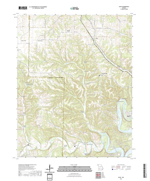
2021 Map of Elsey
USGS Topo · Published 2021About this map
The settlement of Elsey sits in the Ozark hills of Stone County, where the landscape is defined by an intricate network of deep hollows and high ridges. Significant for family historians, the area is home to several well-maintained burial grounds including Hilton Cem, Noland Cem, and Summers Cem. The map illustrates a transition from the narrow drainages of Peavine Hollow and Slickrock Hollow toward the broadening waters of Table Rock Lake in the southeast. This shoreline includes the prominent McCord Bend and the distinctive curve of Horse Shoe Bend. Transport in the region relies on a mix of state routes and rural connectors such as State Hwy 173 and Flat Creek Rd, which navigate the winding topography around Cross Roads. The presence of numerous named springs, such as Carney Spring, highlights the karst-influenced hydrology of this Missouri landscape.
Find a feature on this map
96 named features on this map. Tap any name to fly to it.
Don’t see what you’re looking for? This feature index may not catch every label — zoom into the map to look around manually.
Map Details
Editions of this 2021 Elsey Map
This is the sole edition of this map. No revisions or reprints were ever made.
Other maps of this area

1907 · Forsyth
USGS Topo · 1:125,000

1927 · Shell Knob
USGS Topo · 1:62,500

1942 · Aurora
USGS Topo · 1:62,500

1945 · Harrison
USGS Topo · 1:250,000

1945 · Aurora
USGS Topo · 1:62,500

1949 · Harrison
USGS Topo · 1:250,000

1950 · Shell Knob
USGS Topo · 1:62,500

1954 · Harrison
USGS Topo · 1:250,000
1955 · Hurley
USGS Topo · 1:24,000
1956 · Reeds Spring
USGS Topo · 1:24,000