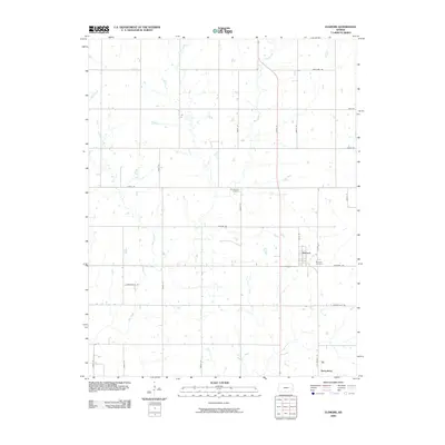
2009 Map of Elsmore
USGS Topo · Published 2009About this map
Elsmore and Savonburg anchor this rural Allen County landscape, where the agricultural grid is defined by a series of state-named thoroughfares. The drainage of Big Creek, Mud Creek, and Little Creek creates a winding contrast to the rigid geometry of roads like Hawaii Rd, Florida Rd, and Connecticut Rd. For those tracing local heritage, the map identifies two distinct burial sites: the Elsmore Cemetery located just southeast of its namesake town, and the Old Elsmore Cemetery situated further north along 4000th St. This 2009 survey highlights a stable Kansas prairie environment where small-town clusters remain centered around historical transit corridors like N Walnut St in Savonburg.
Find a feature on this map
28 named features on this map. Tap any name to fly to it.
Don’t see what you’re looking for? This feature index may not catch every label — zoom into the map to look around manually.
Map Details
Editions of this 2009 Elsmore Map
This is the sole edition of this map. No revisions or reprints were ever made.
Other maps of this area

1886 · Iola
USGS Topo · 1:125,000

1893 · Iola
USGS Topo · 1:125,000

1904 · Iola
USGS Topo · 1:125,000

1947 · Joplin
USGS Topo · 1:250,000

1948 · Erie
USGS Topo · 1:62,500

1949 · Erie
USGS Topo · 1:62,500

1949 · Joplin
USGS Topo · 1:250,000
1951 · Chanute
USGS Topo · 1:62,500

1954 · Joplin
USGS Topo · 1:250,000

1958 · Joplin
USGS Topo · 1:250,000