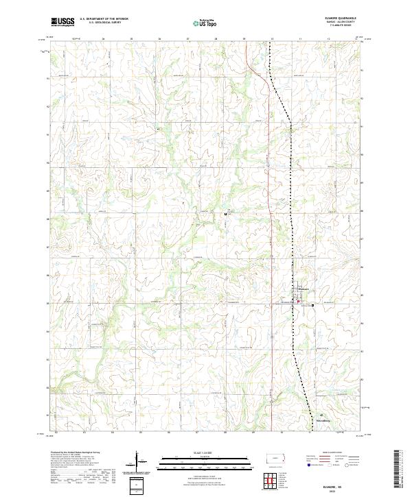
2022 Map of Elsmore
USGS Topo · Published 2022About this map
Elsmore and Savonburg anchor this section of Allen County, where the landscape is defined by a grid of agricultural roads named after various states, including Maryland Rd, Idaho Rd, and Florida Rd. The area is bisected by the north-south corridor of 4200th St, while the local creek system, including Big Cr and Little Cr, meanders through the township ranges of T25S and T26S. Genealogists will find the locations of Elsmore Cem and the Old Elsmore Cem essential for tracing local family history. The presence of Railroad St in Elsmore points to the town's historical reliance on rail transit, even as modern infrastructure like Delaware Rd serves the current community. The map provides a clear look at the rural drainage patterns of Canville Cr and Mud Cr as they flow through these Kansas prairie lands.
Find a feature on this map
38 named features on this map. Tap any name to fly to it.
Don’t see what you’re looking for? This feature index may not catch every label — zoom into the map to look around manually.
Map Details
Editions of this 2022 Elsmore Map
This is the sole edition of this map. No revisions or reprints were ever made.
Other maps of this area

1886 · Iola
USGS Topo · 1:125,000

1893 · Iola
USGS Topo · 1:125,000

1904 · Iola
USGS Topo · 1:125,000

1947 · Joplin
USGS Topo · 1:250,000

1948 · Erie
USGS Topo · 1:62,500

1949 · Erie
USGS Topo · 1:62,500

1949 · Joplin
USGS Topo · 1:250,000
1951 · Chanute
USGS Topo · 1:62,500

1954 · Joplin
USGS Topo · 1:250,000

1958 · Joplin
USGS Topo · 1:250,000