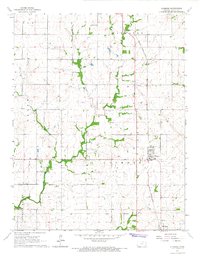
1966 Map of Elsmore
USGS Topo · Published 1967About this map
Savonburg and Elsmore anchor this southeastern Kansas landscape during the mid-1960s, a region defined by its intersection of agricultural prairie and fossil fuel extraction. The Missouri - Kansas - Texas railroad cuts through the terrain, serving the local economy where numerous Oil Wells and Gas Wells are scattered across the townships. A significant historical marker, the Old Indian Treaty Boundary, runs east-to-west across the lower third of the quadrangle, preserving a trace of early territorial divisions beneath the modern grid of sections.
Find a feature on this map
25 named features on this map. Tap any name to fly to it.
Don’t see what you’re looking for? This feature index may not catch every label — zoom into the map to look around manually.
Map Details
Editions of this 1966 Elsmore Map
This is the sole edition of this map. No revisions or reprints were ever made.
Other maps of this area

1886 · Iola
USGS Topo · 1:125,000

1893 · Iola
USGS Topo · 1:125,000

1904 · Iola
USGS Topo · 1:125,000

1947 · Joplin
USGS Topo · 1:250,000

1948 · Erie
USGS Topo · 1:62,500

1949 · Erie
USGS Topo · 1:62,500

1949 · Joplin
USGS Topo · 1:250,000
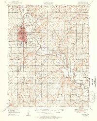
1951 · Chanute
USGS Topo · 1:62,500

1954 · Joplin
USGS Topo · 1:250,000

1958 · Joplin
USGS Topo · 1:250,000