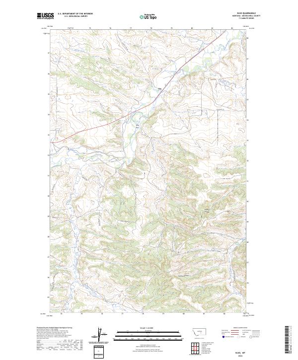
2024 Map of Elso
USGS Topo · Published 2024About this map
The Musselshell River winds through this central Montana landscape, defining a corridor of activity between the settlements of Elso and Stag Run. The map illustrates a developed irrigation system essential to the region's agricultural character, featuring the Glennie Ditch and Naderman Ditch which divert water along the valley floor. The surrounding topography is marked by significant drainages such as Stanley Creek and the deep incisions of Lamott Coulee and Sjandy Coulee, which shape the high ground overlooking the river basin. A network of local ranch and access roads, including Cottonwood Rd and Raths Ln, connects the dispersed homesteads and range lands. The Southern half of the map is dominated by more complex terrain where the East Fork Dean Creek and Goulding Creek carve through the breaks.
Find a feature on this map
29 named features on this map. Tap any name to fly to it.
Don’t see what you’re looking for? This feature index may not catch every label — zoom into the map to look around manually.
Map Details
Editions of this 2024 Elso Map
This is the sole edition of this map. No revisions or reprints were ever made.
Other maps of this area

1954 · Roundup
USGS Topo · 1:250,000

1958 · Roundup
USGS Topo · 1:250,000

1979 · Roundup
USGS Topo · 1:100,000

1979 · Bundy
USGS Topo · 1:24,000

1979 · Timber Buttes South
USGS Topo · 1:24,000

1979 · Harper Coulee
USGS Topo · 1:24,000

1979 · Elso
USGS Topo · 1:24,000

1979 · Hay Basin NE
USGS Topo · 1:24,000

1979 · Horsethief Creek
USGS Topo · 1:24,000

1979 · Roundup
USGS Topo · 1:24,000