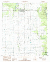
1985 Map of Elton
USGS Topo · Published 1985About this map
The town of Elton serves as the primary hub of this 1985 survey, situated in a landscape defined by the intersection of Jefferson Davis, Allen, Evangeline, and Acadia Parishes. The map illustrates a region transitioning between agricultural use and resource extraction, notably highlighted by an Oil And Gas Field located near the small settlement of China. A complex network of irrigation and drainage is evident through numerous flumes and the winding paths of Bayou Blue and Bayou Nezpique. Smaller rural communities like Barnsdall appear alongside several local Cem sites, which offer valuable data points for genealogical research. The natural topography is shaped by various waterways, including Dry Slough, Bayou Alligator, and the West Bayou Grand Marais, alongside a prominent Pipeline that underscores the industrial character of the mid-1980s Louisiana prairie.
Find a feature on this map
17 named features on this map. Tap any name to fly to it.
Don’t see what you’re looking for? This feature index may not catch every label — zoom into the map to look around manually.
Map Details
Editions of this 1985 Elton Map
This is the sole edition of this map. No revisions or reprints were ever made.
Other maps of this area

1947 · Evangeline
USGS Topo · 1:31,680

1947 · Kinder
USGS Topo · 1:31,680

1947 · Fruge Lake
USGS Topo · 1:31,680

1947 · Oberlin
USGS Topo · 1:31,680

1947 · Pine Island
USGS Topo · 1:31,680

1947 · Elton
USGS Topo · 1:31,680

1947 · Hathaway
USGS Topo · 1:31,680

1947 · Basile
USGS Topo · 1:31,680

1949 · Bayou Blue
USGS Topo · 1:31,680

1949 · Basile
USGS Topo · 1:31,680