Loading...
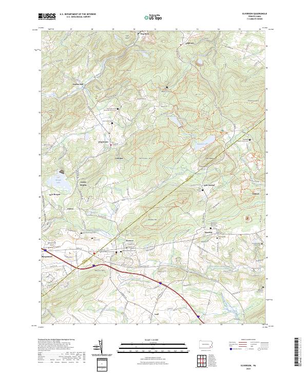
Loading map...2023 Map of Elverson
USGS Topo · Published 2023About this map
Hopewell Furnace National Historic Site anchors the northern reaches of this landscape on the Berks and Chester County line, highlighting the region's deep industrial heritage. The terrain is defined by the prominent elevations of Welsh Mtn and Long Mtn, which frame a complex network of headwaters including the East Branch Conestoga River and the South Branch French Creek.
Find a feature on this map
163 named features on this map. Tap any name to fly to it.
Don’t see what you’re looking for? This feature index may not catch every label — zoom into the map to look around manually.
Map Details
Date Portrayed2023
Date Published2023
PublisherU.S. Geological Survey
Map TypeTopographic
Scale1:24000
Physical Dimensions24 x 29 inches
Editions of this 2023 Elverson Map
This is the sole edition of this map. No revisions or reprints were ever made.
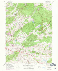
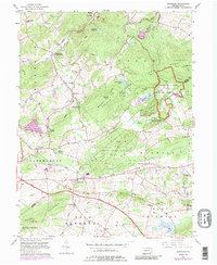
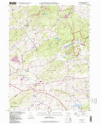
Historical Maps of Conestoga Through Time
4 maps found
Featured Locations
- Elverson, PA
- Warwick Township, PA
- East Nantmeal Township, PA
- Cold Run, Robeson Township
- Loag, West Nantmeal Township
Source Details
SourceU.S. Geological Survey
CopyrightPublic Domain