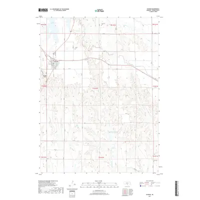
2017 Map of Elwood
USGS Topo · Published 2017About this map
Elwood serves as the primary hub of this Gosper County landscape, with its residential grid extending through streets like Oakland Ave and Smith Ave. The surrounding rural territory is defined by an extensive water management system, including the prominent Elwood Reservoir and specialized irrigation features like Lateral E-65. These man-made improvements sit alongside natural drainages such as Plum Cr and the branches of Turkey Creek, illustrating the sophisticated water engineering required for agriculture in the region.
Find a feature on this map
52 named features on this map. Tap any name to fly to it.
Don’t see what you’re looking for? This feature index may not catch every label — zoom into the map to look around manually.
Map Details
Editions of this 2017 Elwood Map
This is the sole edition of this map. No revisions or reprints were ever made.
Other maps of this area

1896 · Lexington
USGS Topo · 1:125,000

1896 · Arapahoe
USGS Topo · 1:125,000

1898 · Arapahoe
USGS Topo · 1:125,000

1899 · Lexington
USGS Topo · 1:125,000

1955 · Grand Island
USGS Topo · 1:250,000

1957 · Grand Island
USGS Topo · 1:250,000

1958 · Grand Island
USGS Topo · 1:250,000

1962 · Bertrand NW
USGS Topo · 1:24,000
1971 · Arapahoe NE
USGS Topo · 1:24,000
1971 · Johnson Lake
USGS Topo · 1:24,000