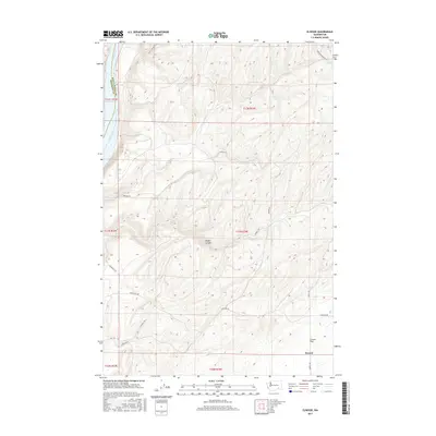
2017 Map of Elwood
USGS Topo · Published 2017About this map
Elwood sits at the southern edge of this landscape where the high plateau of Eureka Flat begins its descent toward the winding Snake River. The terrain is defined by deep incisions like Walker Canyon, which cuts through the agricultural uplands toward the river valley to the west. This region along the Walla Walla and Franklin County line is characterized by a network of rural routes, including Wooden Rd and Harsell Rd, that connect isolated farmsteads and agricultural plots. The northwestern corner reveals the river's edge near Sacajawea, a point of historical significance where the topography shifts from high tillable flats to the steep river break. Modern infrastructure is evident through the path of Lower Monumental Rd and Scott Station Rd, which follow the contours of the land to navigate the dramatic elevation changes typical of this part of eastern Washington.
Find a feature on this map
22 named features on this map. Tap any name to fly to it.
Don’t see what you’re looking for? This feature index may not catch every label — zoom into the map to look around manually.
Map Details
Editions of this 2017 Elwood Map
This is the sole edition of this map. No revisions or reprints were ever made.
Other maps of this area

1915 · Wallulah
USGS Topo · 1:96,000

1916 · Connell
USGS Topo · 1:125,000

1918 · Connell
USGS Topo · 1:125,000

1918 · Wallula
USGS Topo · 1:125,000

1919 · Walla Walla
USGS Topo · 1:125,000

1921 · Walla Walla
USGS Topo · 1:125,000

1948 · Ayer
USGS Topo · 1:62,500

1950 · Haas
USGS Topo · 1:62,500

1953 · Walla Walla
USGS Topo · 1:250,000

1958 · Walla Walla
USGS Topo · 1:250,000