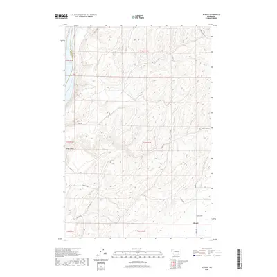
2020 Map of Elwood
USGS Topo · Published 2020About this map
Elwood is situated near the southeastern edge of this high-plateau landscape, where the agricultural plains of Eureka Flat transition into the deeply carved drainage systems of the inland Northwest. The western boundary is defined by the Snake River, which here forms Lake Sacajawea behind down-river dams. The topography is dominated by dramatic coulee-like formations including Walker Canyon, which cuts a prominent path toward the river valley. A network of rural section-line roads, such as Sheffler Rd, Harsell Rd, and Eureka North Rd, reveals the enduring rectangular survey grid that organizes the large-scale dryland farming operations characteristic of Walla Walla County and neighboring Franklin County. This modern topographic study shows the region's sophisticated water management and transportation routes like Wooden Rd that navigate the varied elevations between the flats and the river breaks.
Find a feature on this map
22 named features on this map. Tap any name to fly to it.
Don’t see what you’re looking for? This feature index may not catch every label — zoom into the map to look around manually.
Map Details
Editions of this 2020 Elwood Map
This is the sole edition of this map. No revisions or reprints were ever made.
Other maps of this area

1915 · Wallulah
USGS Topo · 1:96,000

1916 · Connell
USGS Topo · 1:125,000

1918 · Connell
USGS Topo · 1:125,000

1918 · Wallula
USGS Topo · 1:125,000

1919 · Walla Walla
USGS Topo · 1:125,000

1921 · Walla Walla
USGS Topo · 1:125,000

1948 · Ayer
USGS Topo · 1:62,500

1950 · Haas
USGS Topo · 1:62,500

1953 · Walla Walla
USGS Topo · 1:250,000

1958 · Walla Walla
USGS Topo · 1:250,000