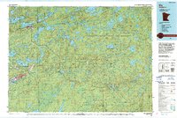
1994 Map of Ely
USGS Topo · Published 1994About this map
Ely serves as the focal point of this northern Minnesota landscape, where the iron mining legacy of the Mesabi and Vermilion ranges meets the expansive protected wilds of the mid-1990s. The map illustrates a complex transition from industrial activity, such as the Mine works south of Babbitt, to the protected reaches of the Boundary Waters Canoe Area Wilderness. This geography is defined by its water, with Shagawa Lake, White Iron Lake, and Birch Lake forming a dense network of interconnected routes through the Superior National Forest.
Find a feature on this map
41 named features on this map. Tap any name to fly to it.
Don’t see what you’re looking for? This feature index may not catch every label — zoom into the map to look around manually.
Map Details
Editions of this 1994 Ely Map
This is the sole edition of this map. No revisions or reprints were ever made.
Other maps of this area

1933 · Ely
USGS Topo · 1:62,500

1939 · Ely
USGS Topo · 1:62,500

1949 · Isaac Lake
USGS Topo · 1:24,000

1949 · Allen
USGS Topo · 1:24,000

1950 · Isaac Lake
USGS Topo · 1:24,000

1950 · Allen
USGS Topo · 1:24,000

1951 · Babbitt SW
USGS Topo · 1:24,000

1951 · Babbitt
USGS Topo · 1:24,000

1952 · Babbitt SE
USGS Topo · 1:24,000

1952 · Babbitt NE
USGS Topo · 1:24,000