
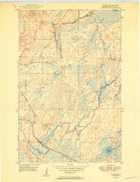
1950 Map of Allen
USGS Topo · Published 1950About this map
The industrial and wilderness character of St. Louis County is on full display in this post-war survey of the Mesaba Range. At the heart of the landscape is the Duluth Missabe and Iron Range railroad, which snakes through the terrain to support the region's iron ore legacy. Small outposts such as Niemi Camp and MacDonald Camp are noted within the expansive Superior National Forest, illustrating the remote nature of these work and resource sites.
Find a feature on this map
19 named features on this map. Tap any name to fly to it.
Don’t see what you’re looking for? This feature index may not catch every label — zoom into the map to look around manually.
Map Details
Editions of this 1950 Allen Map
2 editions found
Other maps of this area

1949 · Aurora
USGS Topo · 1:24,000

1949 · Isaac Lake
USGS Topo · 1:24,000

1949 · Allen
USGS Topo · 1:24,000

1949 · Embarrass
USGS Topo · 1:24,000

1950 · Isaac Lake
USGS Topo · 1:24,000

1950 · Embarrass
USGS Topo · 1:24,000

1950 · Aurora
USGS Topo · 1:24,000

1951 · Babbitt SW
USGS Topo · 1:24,000

1951 · Babbitt
USGS Topo · 1:24,000

1954 · Two Harbors
USGS Topo · 1:250,000