
1950 Map of Embarrass
USGS Topo · Published 1950About this map
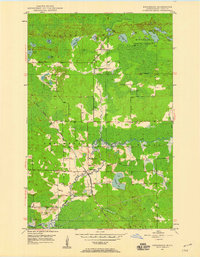
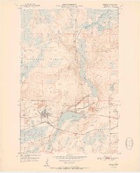
The Embarrass River winds through this section of St. Louis County, defining a landscape shaped by both its glacial hydrology and the industrial reach of the Duluth Missabe and Iron Range railroad. The settlement of Embarrass serves as the focal point, situated near a Gaging Sta and School No 70. This mid-century survey illustrates the transition from the forested wetlands of the Minnesota State Forest to the edges of the Iron Range, where infrastructure like the Pumping Sta at the river's bend supported the region's resource-based economy. Numerous small, family-named or descriptive water bodies such as Heikkilla Lake, Lempia Lakes, and Duck Lake dot the terrain, reflecting the Finnish heritage and local geography of the Iron Range’s eastern reaches. The rail lines and secondary roads trace the higher ground between expansive marshlands and numerous tributary creeks like Bear Creek.
Find a feature on this map
26 named features on this map. Tap any name to fly to it.
Don’t see what you’re looking for? This feature index may not catch every label — zoom into the map to look around manually.
Map Details
Editions of this 1950 Embarrass Map
This is the sole edition of this map. No revisions or reprints were ever made.
Other maps of this area

1949 · Aurora
USGS Topo · 1:24,000

1949 · Isaac Lake
USGS Topo · 1:24,000

1949 · Allen
USGS Topo · 1:24,000
1949 · Embarrass
USGS Topo · 1:24,000

1950 · Isaac Lake
USGS Topo · 1:24,000
1950 · Allen
USGS Topo · 1:24,000

1950 · Aurora
USGS Topo · 1:24,000
1950 · Biwabik
USGS Topo · 1:24,000
1950 · Biwabik NE
USGS Topo · 1:24,000
1951 · Biwabik
USGS Topo · 1:24,000