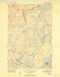
1950 Map of Allen
USGS Topo · Published 1950About this map
The Duluth Missabe and Iron Range railroad snakes through the St. Louis County wilderness in this mid-century survey, providing a vital industrial link between the iron-rich terrain and the port cities. The small settlement of Allen and the nearby station at Wyman anchor the southwest, while logging and mining camps like Niemi Camp and MacDonald Camp are scattered across the landscape. Much of the eastern portion is dominated by the One Hundred Mile Swamp within the Superior National Forest, a terrain characterized by slow-moving water and dense wetlands.
Find a feature on this map
19 named features on this map. Tap any name to fly to it.
Don’t see what you’re looking for? This feature index may not catch every label — zoom into the map to look around manually.
Map Details
Editions of this 1950 Allen Map
2 editions found
Other maps of this area

1949 · Aurora
USGS Topo · 1:24,000

1949 · Isaac Lake
USGS Topo · 1:24,000

1949 · Allen
USGS Topo · 1:24,000

1949 · Embarrass
USGS Topo · 1:24,000

1950 · Isaac Lake
USGS Topo · 1:24,000

1950 · Embarrass
USGS Topo · 1:24,000

1950 · Allen
USGS Topo · 1:24,000

1950 · Aurora
USGS Topo · 1:24,000

1951 · Babbitt SW
USGS Topo · 1:24,000

1951 · Babbitt
USGS Topo · 1:24,000