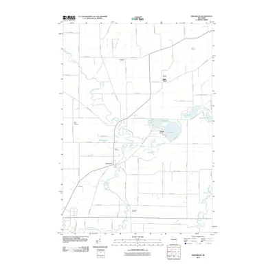
2010 Map of Embarrass
USGS Topo · Published 2010About this map
The Embarrass River meanders across this landscape, defining the character of the namesake village of Embarrass and the surrounding township of Belle Plaine. This 2010 survey details a region defined by its complex hydrology and agricultural layout, where the river system is joined by Matteson Creek, Beaver Creek, and the Wolf River in the southeast. Significant for genealogists, the map identifies several local burial grounds including Friendship Cemetery, Bomke Cemetery, Saint Peter Cemetery, Zion Cemetery, and Greenwood Cemetery.
Find a feature on this map
67 named features on this map. Tap any name to fly to it.
Don’t see what you’re looking for? This feature index may not catch every label — zoom into the map to look around manually.
Map Details
Editions of this 2010 Embarrass Map
This is the sole edition of this map. No revisions or reprints were ever made.
Other maps of this area

1954 · Gresham
USGS Topo · 1:48,000

1954 · Shawano
USGS Topo · 1:48,000

1955 · Embarrass
USGS Topo · 1:48,000

1955 · Clintonville
USGS Topo · 1:48,000

1955 · Green Bay
USGS Topo · 1:250,000

1964 · Shawano
USGS Topo · 1:62,500

1964 · Gresham
USGS Topo · 1:62,500

1969 · Leeman
USGS Topo · 1:24,000

1969 · Embarrass
USGS Topo · 1:24,000

1969 · Lunds
USGS Topo · 1:24,000