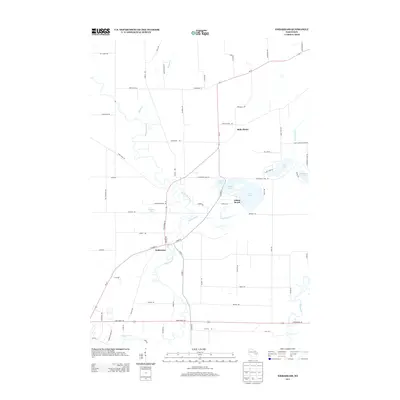
2013 Map of Embarrass
USGS Topo · Published 2013About this map
The village of Embarrass serves as a central hub in this survey, situated where the meandering Embarrass River meets a network of local roads including W Main St and Grand Ave. The landscape is defined by its complex hydrology, with the river's winding oxbows and tributaries like Matteson Cr creating a varied topography north of State Road 156. Further east, a cluster of glacial lakes—including Round Lake, Grass Lake, and Pine Lake—draws the eye toward the settlement of Adams Beach. This area reflects a quiet, lake-front character, while to the north, the community of Belle Plaine stands amidst the agricultural parcels of Waupaca County. The eastern edge of the map is bordered by the Wolf River, highlighting the region's importance as a watershed. Local history researchers will find value in the specific road names like Warren Hansen Dr and Kleiner Rd, which often signal family-held land and early local transit routes.
Find a feature on this map
72 named features on this map. Tap any name to fly to it.
Don’t see what you’re looking for? This feature index may not catch every label — zoom into the map to look around manually.
Map Details
Editions of this 2013 Embarrass Map
This is the sole edition of this map. No revisions or reprints were ever made.
Other maps of this area

1954 · Gresham
USGS Topo · 1:48,000

1954 · Shawano
USGS Topo · 1:48,000

1955 · Embarrass
USGS Topo · 1:48,000

1955 · Clintonville
USGS Topo · 1:48,000

1955 · Green Bay
USGS Topo · 1:250,000

1964 · Shawano
USGS Topo · 1:62,500

1964 · Gresham
USGS Topo · 1:62,500

1969 · Leeman
USGS Topo · 1:24,000

1969 · Embarrass
USGS Topo · 1:24,000

1969 · Lunds
USGS Topo · 1:24,000