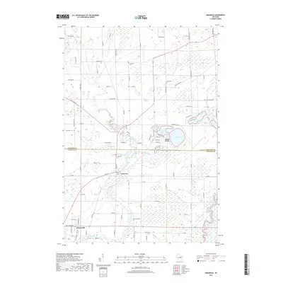
2018 Map of Embarrass
USGS Topo · Published 2018About this map
The confluence of the Embarrass River and Matteson Cr anchors the village of Embarrass in this 2018 survey. The landscape is defined by its complex hydrography, where the Wolf River snakes through the eastern wetlands while the Pigeon River flows through the southern outskirts of Clintonville. This area, split by the Shawano Co / Waupaca Co line, reveals a pattern of rural development centered around small water bodies like Wagner Lake, Long Lake, and Pine Lake. Researchers will find several distinct burial grounds, including Friendship Cem, Bomke Cem, and Greenwood Cem, which serve as vital markers for local family histories. The presence of Adams Beach on the shores of Grass Lake suggests a community shaped by both agricultural industry and the recreational value of the northern Wisconsin lake country.
Find a feature on this map
96 named features on this map. Tap any name to fly to it.
Don’t see what you’re looking for? This feature index may not catch every label — zoom into the map to look around manually.
Map Details
Editions of this 2018 Embarrass Map
This is the sole edition of this map. No revisions or reprints were ever made.
Other maps of this area

1954 · Gresham
USGS Topo · 1:48,000

1954 · Shawano
USGS Topo · 1:48,000

1955 · Embarrass
USGS Topo · 1:48,000

1955 · Clintonville
USGS Topo · 1:48,000

1955 · Green Bay
USGS Topo · 1:250,000

1964 · Shawano
USGS Topo · 1:62,500

1964 · Gresham
USGS Topo · 1:62,500

1969 · Leeman
USGS Topo · 1:24,000

1969 · Embarrass
USGS Topo · 1:24,000

1969 · Lunds
USGS Topo · 1:24,000