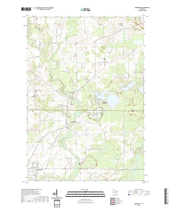
2022 Map of Embarrass
USGS Topo · Published 2022About this map
The Embarrass River meanders through this landscape on the border of Shawano and Waupaca Counties, anchoring a network of small lakeside communities and agricultural homesteads. The village of Embarrass serves as a central point, while the northern edge of Clintonville occupies the southwestern corner near the Pigeon River. This 2022 survey captures the modern rural character of the region, featuring several small lakes including Pine Lake, Round Lake, and Grass Lake, which support the seasonal community of Adams Beach. Local history is preserved in several family and community burial grounds scattered throughout the township, such as Greenwood Cem, Friendship Cem, and the Zion Lutheran Cem. The terrain is further defined by the convergence of several waterways, including the Wolf River and Matteson Cr, which navigate the low-lying wetlands and glaciated plains typical of central Wisconsin.
Find a feature on this map
97 named features on this map. Tap any name to fly to it.
Don’t see what you’re looking for? This feature index may not catch every label — zoom into the map to look around manually.
Map Details
Editions of this 2022 Embarrass Map
This is the sole edition of this map. No revisions or reprints were ever made.
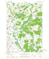
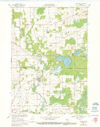
Historical Maps of Adams Beach Through Time
3 maps found