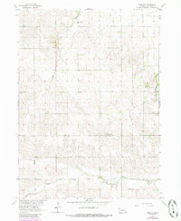
1963 Map of Emerick
USGS Topo · Published 1985About this map
Emerick lies at the intersection of rural township lines in Madison County, serving as a focal point for a landscape defined by its stream valleys and agricultural divisions. This survey, conducted as part of the Missouri River Basin development project, highlights the drainage patterns of Deer Creek in the north and the meandering Battle Creek in the south. The placement of civic institutions reflects the decentralized nature of the community during this era, with the Deer Creek Sch and Highland View Sch situated to serve the surrounding farmsteads. Local genealogy is anchored by the Hutchins Cem and Osborn Cem, which provide specific points of reference for families settled along the range lines between R. 4 W. and R. 3 W. The map captures the territory before modern consolidation, preserving the locations of the original country schools and cemeteries that defined early Nebraska rural life.
Find a feature on this map
11 named features on this map. Tap any name to fly to it.
Don’t see what you’re looking for? This feature index may not catch every label — zoom into the map to look around manually.
Map Details
Editions of this 1963 Emerick Map
2 editions found
Other maps of this area

1955 · Sioux City
USGS Topo · 1:250,000

1955 · Fremont
USGS Topo · 1:250,000

1957 · Fremont
USGS Topo · 1:250,000

1958 · Sioux City
USGS Topo · 1:250,000

1958 · Fremont
USGS Topo · 1:250,000

1959 · Sioux City
USGS Topo · 1:250,000

1963 · Battle Creek
USGS Topo · 1:24,000

1963 · Pierce SE
USGS Topo · 1:24,000

1963 · Emerick
USGS Topo · 1:24,000

1963 · Meadow Grove
USGS Topo · 1:24,000