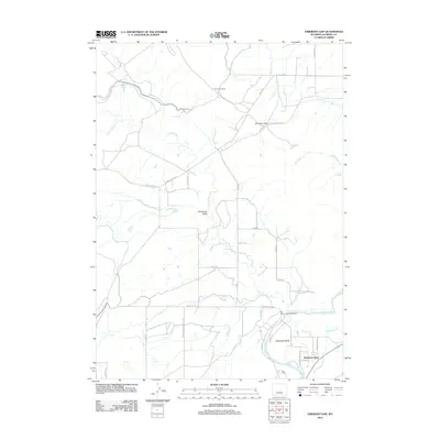
2012 Map of Emigrant Gap
USGS Topo · Published 2012About this map
Bessemer Bend anchors the southeastern corner of this landscape, where the N Platte River makes its wide sweep through Natrona County. The map details a transition from the riparian environment of the river bottom to the high, arid drainage basins defined by Poison Spider Cr and Iron Cr. Historic movement across the terrain is evident along the Oregon Trail Rd, which cuts through the central portion of the quadrangle near Clevidence Draw. Local infrastructure includes Tunnel Number 6 and a network of rural roads such as Poison Spider Rd and Bessemer Bend Rd that service the ranching community. The presence of the Old Goose Egg Ranchhouse near the river indicates the long-standing agricultural roots of the area, while names like Emigrant Gap evoke the geography that once guided westward travelers through this high desert country.
Find a feature on this map
31 named features on this map. Tap any name to fly to it.
Don’t see what you’re looking for? This feature index may not catch every label — zoom into the map to look around manually.
Map Details
Editions of this 2012 Emigrant Gap Map
This is the sole edition of this map. No revisions or reprints were ever made.
Other maps of this area

1950 · Emigrant Gap
USGS Topo · 1:24,000

1950 · Goose Egg
USGS Topo · 1:24,000

1950 · Emigrant Gap NE
USGS Topo · 1:24,000

1951 · Oil Mountain
USGS Topo · 1:24,000

1951 · Clarkson Hill
USGS Topo · 1:24,000

1951 · Emigrant Gap NW
USGS Topo · 1:24,000

1951 · Bessemer Mountain
USGS Topo · 1:24,000

1952 · Bishop
USGS Topo · 1:24,000

1955 · Casper
USGS Topo · 1:250,000

1958 · Casper
USGS Topo · 1:250,000