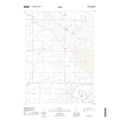
2017 Map of Emigrant Gap
USGS Topo · Published 2017About this map
The North Platte River winds through the southern portion of this landscape, carving the distinctive loop at Bessemer Bend. This area serves as a critical junction for historical movement, anchored by Emigrant Gap and the nearby Emigrant Gap Ridge. The irrigation infrastructure of the high desert is prominently displayed through the Casper Canal, which includes the engineering feat of Tunnel Number 6. The rugged topography is defined by numerous drainages such as Sixmile Draw, Clevidence Draw, and Poison Spider Cr, all contributing to the complex hydrology west of the Red Buttes landmark. Local transit is marked by a network of county roads and uniquely named paths like Black Widow Rd and Mystic Moon Trl, reflecting the modern rural character of this Natrona County region.
Find a feature on this map
43 named features on this map. Tap any name to fly to it.
Don’t see what you’re looking for? This feature index may not catch every label — zoom into the map to look around manually.
Map Details
Editions of this 2017 Emigrant Gap Map
This is the sole edition of this map. No revisions or reprints were ever made.
Other maps of this area

1950 · Emigrant Gap
USGS Topo · 1:24,000

1950 · Goose Egg
USGS Topo · 1:24,000

1950 · Emigrant Gap NE
USGS Topo · 1:24,000

1951 · Oil Mountain
USGS Topo · 1:24,000

1951 · Clarkson Hill
USGS Topo · 1:24,000

1951 · Emigrant Gap NW
USGS Topo · 1:24,000

1951 · Bessemer Mountain
USGS Topo · 1:24,000

1952 · Bishop
USGS Topo · 1:24,000

1955 · Casper
USGS Topo · 1:250,000

1958 · Casper
USGS Topo · 1:250,000