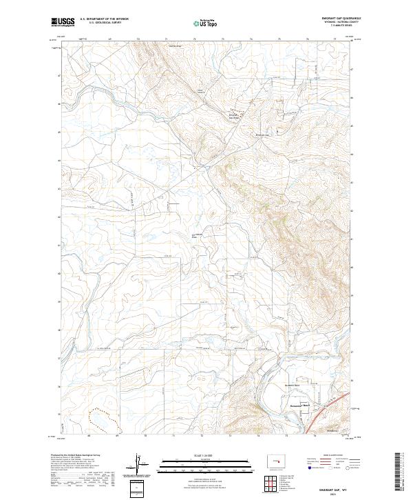
2021 Map of Emigrant Gap
USGS Topo · Published 2021About this map
Bessemer Bend serves as a focal point in this Natrona County landscape, situated along a prominent curve of the North Platte River near the southern edge of the survey. The terrain is defined by a series of drainage systems including Poison Spider Cr, Sixmile Draw, and Clevidence Draw, which carve through the high ground of Emigrant Gap Ridge. This topographical arrangement highlights the historical importance of natural corridors like Emigrant Gap for movement across the region.
Find a feature on this map
41 named features on this map. Tap any name to fly to it.
Don’t see what you’re looking for? This feature index may not catch every label — zoom into the map to look around manually.
Map Details
Editions of this 2021 Emigrant Gap Map
This is the sole edition of this map. No revisions or reprints were ever made.
Other maps of this area

1950 · Emigrant Gap
USGS Topo · 1:24,000

1950 · Goose Egg
USGS Topo · 1:24,000

1950 · Emigrant Gap NE
USGS Topo · 1:24,000

1951 · Oil Mountain
USGS Topo · 1:24,000

1951 · Clarkson Hill
USGS Topo · 1:24,000

1951 · Emigrant Gap NW
USGS Topo · 1:24,000

1951 · Bessemer Mountain
USGS Topo · 1:24,000

1952 · Bishop
USGS Topo · 1:24,000

1955 · Casper
USGS Topo · 1:250,000

1958 · Casper
USGS Topo · 1:250,000