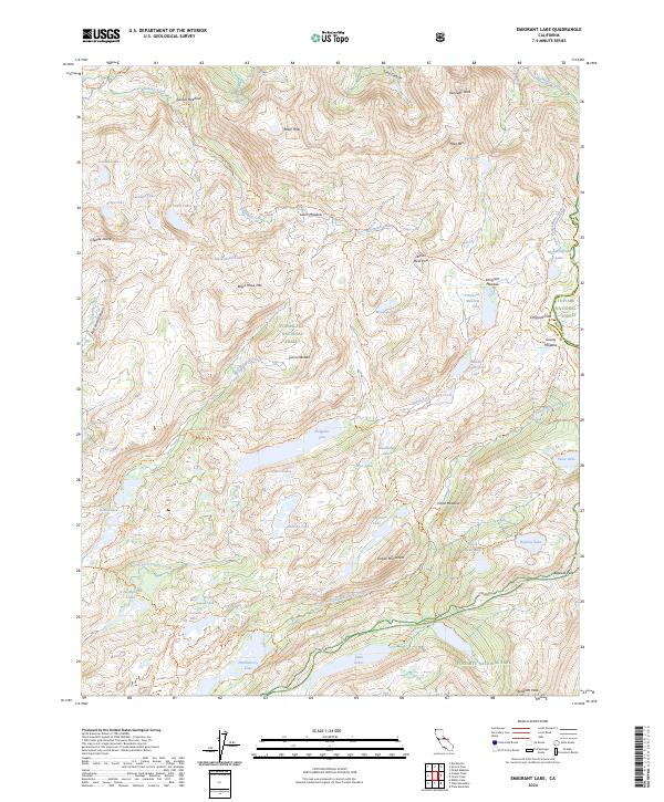
2024 Map of Emigrant Lake
USGS Topo · Published 2024About this map
Emigrant Wilderness and the high Sierra Nevada define this 2024 landscape, which spans the boundary of Mono and Tuolumne counties. The area is characterized by a dense network of alpine water bodies including Emigrant Lake, Huckleberry Lake, and the clustered Buck Lakes. These basins are linked by established paths such as the Huckleberry Trl and the Crabtree Trl, illustrating a region dedicated to primitive recreation and conservation within the Stanislaus National Forest.
Find a feature on this map
71 named features on this map. Tap any name to fly to it.
Don’t see what you’re looking for? This feature index may not catch every label — zoom into the map to look around manually.
Map Details
Editions of this 2024 Emigrant Lake Map
This is the sole edition of this map. No revisions or reprints were ever made.
Other maps of this area

1896 · Dardanelles
USGS Topo · 1:125,000

1898 · Dardanelles
USGS Topo · 1:125,000

1948 · Walker Lake
USGS Topo · 1:250,000

1954 · Pickel Meadow
USGS Topo · 1:24,000

1956 · Dardanelles Cone
USGS Topo · 1:62,500

1956 · Pinecrest
USGS Topo · 1:62,500

1956 · Sonora Pass
USGS Topo · 1:62,500
1956 · Tower Peak
USGS Topo · 1:62,500

1957 · Walker Lake
USGS Topo · 1:250,000

1962 · Walker Lake
USGS Topo · 1:250,000