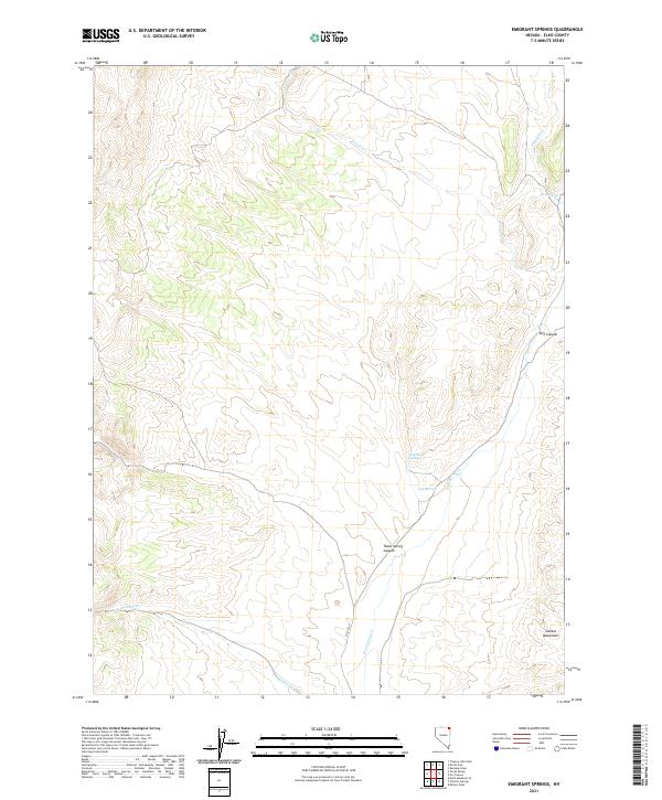
2021 Map of Emigrant Springs
USGS Topo · Published 2021About this map
Emigrant Springs and Rock Spring serve as vital water markers in this arid section of northeast Elko County, highlighting the historical reliance on reliable springs in the high desert basin. The landscape is defined by its drainage systems, including Devils Cr and Badger Cr in the northern reaches, which give way to more pronounced relief toward the south. The southeastern corner is dominated by the foothills of the Delano Mountains, where the terrain drops sharply into Dry Canyon and Texas Spring Canyon.
Find a feature on this map
17 named features on this map. Tap any name to fly to it.
Don’t see what you’re looking for? This feature index may not catch every label — zoom into the map to look around manually.
Map Details
Editions of this 2021 Emigrant Springs Map
This is the sole edition of this map. No revisions or reprints were ever made.
Other maps of this area

1955 · Wells
USGS Topo · 1:250,000

1957 · Delaplain
USGS Topo · 1:62,500

1958 · Wells
USGS Topo · 1:250,000

1961 · Wells
USGS Topo · 1:250,000

1961 · Delano Mountains
USGS Topo · 1:62,500

1961 · Gollaher Mountain
USGS Topo · 1:62,500

1968 · Knoll Mountain SE
USGS Topo · 1:24,000

1968 · Texas Spring
USGS Topo · 1:24,000
1980 · Dry Canyon
USGS Topo · 1:24,000

1982 · Jackpot
USGS Topo · 1:100,000