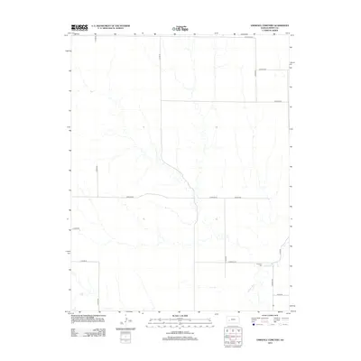
2012 Map of Eminence Cemetery
USGS Topo · Published 2012About this map
Eminence Cem serves as a primary historical marker in this portion of Finney County, situated just north of the winding Pawnee River. The landscape is defined by a strictly organized section-line road network, where routes like E Huschka Rd and E Martin Rd divide the open plains into a geometric grid. These roads often bear names that reflect the local heritage of the region's agricultural families, such as E Wiebe Rd and E Potter Rd. The survey reveals the sparse but deliberate distribution of landmarks in this part of Kansas, where the natural course of the river provides a sharp visual contrast to the rigid human-imposed boundaries of E Eminence Rd and N Road 28.
Find a feature on this map
18 named features on this map. Tap any name to fly to it.
Don’t see what you’re looking for? This feature index may not catch every label — zoom into the map to look around manually.
Map Details
Editions of this 2012 Eminence Cemetery Map
This is the sole edition of this map. No revisions or reprints were ever made.
Other maps of this area

1955 · Scott City
USGS Topo · 1:250,000

1958 · Scott City
USGS Topo · 1:250,000

1974 · Ravanna
USGS Topo · 1:24,000
1974 · Scott City 4 SW
USGS Topo · 1:24,000
1974 · Scott City 4 SE
USGS Topo · 1:24,000
1974 · Scott City 4 NW
USGS Topo · 1:24,000

1974 · Dighton SW
USGS Topo · 1:24,000

1974 · Amy SE
USGS Topo · 1:24,000

1974 · Scott City 4 NE
USGS Topo · 1:24,000

1974 · Amy SW
USGS Topo · 1:24,000