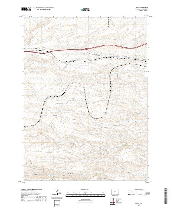
2021 Map of Emkay
USGS Topo · Published 2021About this map
Otto serves as the primary landmark in this section of Laramie County, situated along the corridor of the I-80 SVC RD and Otto Rd. The landscape is defined by a dense drainage network where several named waterways, including Lone Tree Cr, Willow Creek, and Spotwood Cr, carve through the terrain. The presence of rural infrastructure like Goose Creek Rd and Upper Duck Creek Rd indicates the managed nature of this high-plains environment, where surveying boundaries like t13n r69w and t12n r68w define the ranching and land use patterns. This 2021 data from the U.S. Geological Survey provides a precise view of the local topography and watershed management near the Wyoming-Colorado border.
Find a feature on this map
19 named features on this map. Tap any name to fly to it.
Don’t see what you’re looking for? This feature index may not catch every label — zoom into the map to look around manually.
Map Details
Editions of this 2021 Emkay Map
This is the sole edition of this map. No revisions or reprints were ever made.
Other maps of this area

1905 · Sherman
USGS Topo · 1:125,000

1907 · Livermore
USGS Topo · 1:125,000

1908 · Eaton
USGS Topo · 1:125,000

1909 · Livermore
USGS Topo · 1:125,000

1910 · Eaton
USGS Topo · 1:125,000

1911 · Cheyenne
USGS Topo · 1:125,000

1914 · Cheyenne
USGS Topo · 1:125,000

1950 · Cheyenne
USGS Topo · 1:62,500

1954 · Cheyenne
USGS Topo · 1:250,000

1954 · Greeley
USGS Topo · 1:250,000