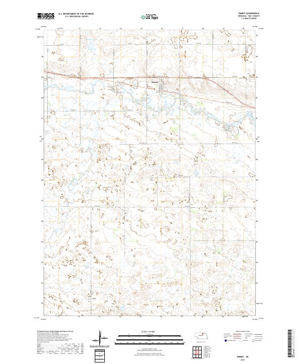
2021 Map of Emmet
USGS Topo · Published 2021About this map
Emmet serves as the central settlement of this Holt County landscape, positioned along the historic transport corridor of the Cowboy Trl and the Old Hwy. The terrain is defined by the winding course of the Elkhorn River, which meanders through the northern half of the township, while Holt Cr drains the southern wetlands. The map illustrates a classic Great Plains section-line road grid, featuring routes such as 874 Rd and 871st Rd that parcel the territory for agriculture. Just north of the main village, Welsh Lake provides a localized landmark within the river valley. The concentration of development remains tightly clustered around Front St in Emmet, reflecting the enduring influence of the rail and highway corridor on the area's layout even into the modern era.
Find a feature on this map
18 named features on this map. Tap any name to fly to it.
Don’t see what you’re looking for? This feature index may not catch every label — zoom into the map to look around manually.
Map Details
Editions of this 2021 Emmet Map
This is the sole edition of this map. No revisions or reprints were ever made.
Other maps of this area

1954 · Atkinson SE
USGS Topo · 1:24,000

1954 · Atkinson
USGS Topo · 1:24,000

1954 · Meek SW
USGS Topo · 1:24,000

1955 · O'Neill
USGS Topo · 1:250,000

1958 · O'Neill
USGS Topo · 1:24,000

1959 · O'Neill
USGS Topo · 1:250,000

1964 · Emmet NW
USGS Topo · 1:24,000

1964 · Emmet SE
USGS Topo · 1:24,000

1964 · Emmet SW
USGS Topo · 1:24,000

1964 · O'Neill SW
USGS Topo · 1:24,000