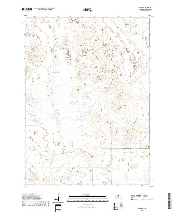
2021 Map of Emmet SE
USGS Topo · Published 2021About this map
Dry Cr winds through the sandhills landscape of northern Nebraska in this 2021 study of eastern Holt County. The area is defined by a sparse network of section-line roads and the undulating topography of the Nebraska Sandhills. A grid of rural routes, including 859 Rd and 485 Ave, provides access to the ranchlands and seasonal wetlands typical of the region. This survey details the township and range boundaries of t27n r13w and surrounding sections, offering a clear view of the modern land divisions and drainage patterns in a remote agricultural environment. The map effectively documents the intersection of natural watercourses like the ephemeral Dry Cr with the engineered county road system of 858 Rd and 486 Rd.
Find a feature on this map
12 named features on this map. Tap any name to fly to it.
Don’t see what you’re looking for? This feature index may not catch every label — zoom into the map to look around manually.
Map Details
Editions of this 2021 Emmet SE Map
This is the sole edition of this map. No revisions or reprints were ever made.
Other maps of this area

1955 · O'Neill
USGS Topo · 1:250,000

1958 · O'Neill
USGS Topo · 1:24,000

1959 · O'Neill
USGS Topo · 1:250,000

1964 · Emmet NW
USGS Topo · 1:24,000

1964 · Emmet SE
USGS Topo · 1:24,000

1964 · Emmet SW
USGS Topo · 1:24,000

1964 · O'Neill SW
USGS Topo · 1:24,000

1964 · Emmet
USGS Topo · 1:24,000

1969 · O'Neill
USGS Topo · 1:250,000

1981 · Amelia
USGS Topo · 1:24,000