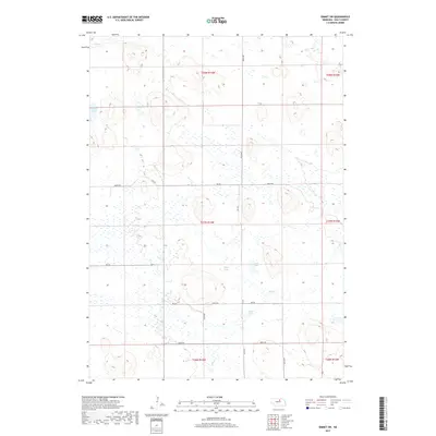
2017 Map of Emmet SW
USGS Topo · Published 2017About this map
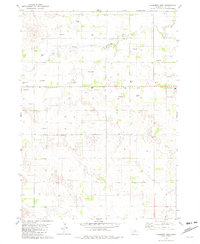
Lizard Lake and a series of smaller water bodies define this portion of the Nebraska Sandhills in Holt County. The landscape is characterized by its internal drainage, where water accumulates in depressions like Gold Lake, West Lake, and East Lake. Small watercourses such as Holt Cr and Dry Cr provide the primary drainage for the area. The land is organized by the Public Land Survey System, spanning portions of Township 26 through 28 North and Ranges 13 through 14 West. Transportation is largely restricted to a grid of section-line roads, including 478th Ave and 862nd Rd, which facilitate movement through this sparsely populated cattle-country environment. The concentration of lakes and wetlands highlights the region's reliance on groundwater and seasonal runoff within the larger Elkhorn River basin system.
Find a feature on this map
22 named features on this map. Tap any name to fly to it.
Don’t see what you’re looking for? This feature index may not catch every label — zoom into the map to look around manually.
Map Details
Editions of this 2017 Emmet SW Map
This is the sole edition of this map. No revisions or reprints were ever made.
Other maps of this area

1955 · O'Neill
USGS Topo · 1:250,000

1959 · O'Neill
USGS Topo · 1:250,000
1964 · Emmet NW
USGS Topo · 1:24,000
1964 · Emmet SE
USGS Topo · 1:24,000
1964 · Emmet SW
USGS Topo · 1:24,000
1964 · Emmet
USGS Topo · 1:24,000
1969 · O'Neill
USGS Topo · 1:250,000
1981 · Swan Lake
USGS Topo · 1:24,000
1981 · Amelia
USGS Topo · 1:24,000
1981 · Chambers West
USGS Topo · 1:24,000