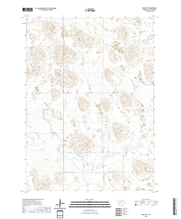
2021 Map of Emmet SW
USGS Topo · Published 2021About this map
The Nebraska Sandhills dominate this portion of Holt County, where wind-shaped terrain creates a landscape of intermittent wetlands and small lakes. Lizard Lake sits in the northwest, while a cluster of water bodies including West Lake, East Lake, and Gold Lake characterize the central and southern sections. These basins are critical features in this semi-arid environment, often serving as vital water sources for cattle ranching operations that have long defined the local economy.
Find a feature on this map
22 named features on this map. Tap any name to fly to it.
Don’t see what you’re looking for? This feature index may not catch every label — zoom into the map to look around manually.
Map Details
Editions of this 2021 Emmet SW Map
This is the sole edition of this map. No revisions or reprints were ever made.
Other maps of this area

1955 · O'Neill
USGS Topo · 1:250,000

1959 · O'Neill
USGS Topo · 1:250,000

1964 · Emmet NW
USGS Topo · 1:24,000

1964 · Emmet SE
USGS Topo · 1:24,000

1964 · Emmet SW
USGS Topo · 1:24,000

1964 · Emmet
USGS Topo · 1:24,000

1969 · O'Neill
USGS Topo · 1:250,000

1981 · Swan Lake
USGS Topo · 1:24,000

1981 · Amelia
USGS Topo · 1:24,000
1981 · Chambers West
USGS Topo · 1:24,000