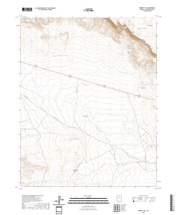
2021 Map of Emmett Hill
USGS Topo · Published 2021About this map
The Vermilion Cliffs dominate the northeastern portion of this survey, marking a dramatic geological transition at the edge of the Paria Plateau. This arid landscape is defined by its scarce but vital water sources, including Jacobs Pool, Hancock Spring, and Sunset Spring, which provided essential stops for early travelers and ranching operations. The terrain descends into the broad House Rock Valley, where House Rock Wash and Emmett Wash drain the surrounding heights.
Find a feature on this map
21 named features on this map. Tap any name to fly to it.
Don’t see what you’re looking for? This feature index may not catch every label — zoom into the map to look around manually.
Map Details
Editions of this 2021 Emmett Hill Map
This is the sole edition of this map. No revisions or reprints were ever made.
Other maps of this area

1886 · Echo Cliffs
USGS Topo · 1:250,000

1886 · Kaibab
USGS Topo · 1:250,000

1891 · Echo Cliffs
USGS Topo · 1:250,000

1936 · Jacobs Lake
USGS Topo · 1:48,000

1940 · Jacob Lake
USGS Topo · 1:62,500

1953 · Jacobs Lake
USGS Topo · 1:62,500

1953 · Grand Canyon
USGS Topo · 1:250,000

1954 · Emmett Wash NE
USGS Topo · 1:24,000

1954 · Emmett Wash NW
USGS Topo · 1:24,000

1954 · Paria Plateau SE
USGS Topo · 1:24,000