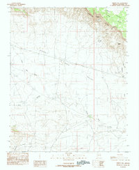
1985 Map of Emmett Hill
USGS Topo · Published 1985About this map
The dramatic elevation shifts of the Vermilion Cliffs dominate this landscape, marking the transition from the high Paria Plateau down into the expansive House Rock Valley. In the mid-1980s, this area remained largely defined by its natural water sources, with Hancock Spring, Jacobs Pool, and Sunset Spring providing critical points of reference in an otherwise arid environment. The presence of Gravel Pits in the valley floor suggests localized material extraction, likely for the maintenance of the unimproved roads and trails that traverse the terrain.
Find a feature on this map
14 named features on this map. Tap any name to fly to it.
Don’t see what you’re looking for? This feature index may not catch every label — zoom into the map to look around manually.
Map Details
Editions of this 1985 Emmett Hill Map
This is the sole edition of this map. No revisions or reprints were ever made.
Other maps of this area

1886 · Echo Cliffs
USGS Topo · 1:250,000

1886 · Kaibab
USGS Topo · 1:250,000

1891 · Echo Cliffs
USGS Topo · 1:250,000

1936 · Jacobs Lake
USGS Topo · 1:48,000

1940 · Jacob Lake
USGS Topo · 1:62,500

1953 · Jacobs Lake
USGS Topo · 1:62,500

1953 · Grand Canyon
USGS Topo · 1:250,000

1954 · Emmett Wash NE
USGS Topo · 1:24,000

1954 · Emmett Wash NW
USGS Topo · 1:24,000

1954 · Paria Plateau SE
USGS Topo · 1:24,000