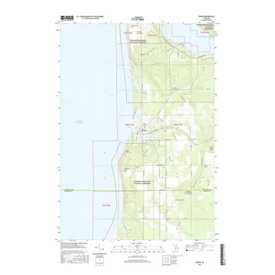
2017 Map of Empire
USGS Topo · Published 2017About this map
Empire stands as the central settlement on this coastal landscape, situated where the dunes meet the inland forests. The map highlights the extensive boundaries of the Sleeping Bear Dunes National Lakeshore, protecting geologic features such as The Sleeping Bear, Old Baldy Dune, and the dramatic Empire Bluffs overlooking Lake Michigan. To the north, the Pierce Stocking Scenic Dr winds through the elevated terrain near Shauger Hill, while a network of rural roads like Wilco Rd and Stormer Rd connect the surrounding township. Genealogists will find several burial grounds documented, including Maple Grove Cem, Empire Catholic Cem, and Platte Cem. The map also traces the Shore to Shore Trail as it traverses the area, passing near Empire Airport and the waters of Taylor Lake and Otter Creek.
Find a feature on this map
65 named features on this map. Tap any name to fly to it.
Don’t see what you’re looking for? This feature index may not catch every label — zoom into the map to look around manually.
Map Details
Editions of this 2017 Empire Map
This is the sole edition of this map. No revisions or reprints were ever made.
Other maps of this area

1954 · Traverse City
USGS Topo · 1:250,000

1954 · Manitowoc
USGS Topo · 1:250,000

1956 · Thompsonville
USGS Topo · 1:62,500

1956 · Frankfort
USGS Topo · 1:62,500

1957 · Empire
USGS Topo · 1:62,500

1957 · Maple City
USGS Topo · 1:62,500

1958 · Traverse City
USGS Topo · 1:250,000

1958 · Manitowoc
USGS Topo · 1:250,000

1976 · Frankfort NW
USGS Topo · 1:24,000

1976 · Thompsonville NW
USGS Topo · 1:24,000