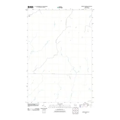
2010 Map of Empire Swamp
USGS Topo · Published 2010About this map
Summit Lookout Tower stands as a prominent sentinel in the northwest corner of this remote Wisconsin landscape, anchored by the E Tower Fire Ln. The terrain is defined by a dense network of hydrologic features, including the winding course of the Upper Tamarack River and the branching reaches of Crotte Creek and Sheosh Creek. This 2010 survey illustrates a region largely shaped by its water and woods, where human transit is limited to a few arterial routes like County Hwy-M and the aptly named Empire Wilderness Rd. The drainage pattern of Thompson Creek and Bear Creek suggests a low-lying, intricate ecosystem characteristic of Douglas County's northern wilds. For researchers, the map provides a precise look at the fire management and forestry infrastructure of the early 21st century, preserved here through its named roads and remaining fire lookout landmarks.
Find a feature on this map
13 named features on this map. Tap any name to fly to it.
Don’t see what you’re looking for? This feature index may not catch every label — zoom into the map to look around manually.
Map Details
Editions of this 2010 Empire Swamp Map
This is the sole edition of this map. No revisions or reprints were ever made.
Other maps of this area

1945 · Solon Springs
USGS Topo · 1:48,000

1947 · Minong
USGS Topo · 1:48,000

1949 · Solon Springs
USGS Topo · 1:48,000

1949 · Minong
USGS Topo · 1:48,000

1949 · Webb Lake
USGS Topo · 1:48,000

1949 · Patzau
USGS Topo · 1:48,000

1953 · Ashland
USGS Topo · 1:250,000

1953 · Duluth
USGS Topo · 1:250,000

1954 · Amnicon Lake
USGS Topo · 1:24,000
1954 · Patzau
USGS Topo · 1:24,000