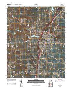
2010 Map of Emporia
USGS Topo · Published 2010About this map
The city of Emporia serves as the central hub of this Southside Virginia landscape, situated where the Meherrin River flows past the Emporia Dam. The 2010 geography reveals a mix of established residential neighborhoods like Westover Hills, Walnut Heights, and Washington Park alongside agricultural operations such as Southern Grove Farms and Parhams Farm. The map provides a high level of detail for those interested in local family history, noting several burial grounds including the Greensville Memorial Cemetery and the Jones Cemetery north of the river.
Find a feature on this map
73 named features on this map. Tap any name to fly to it.
Don’t see what you’re looking for? This feature index may not catch every label — zoom into the map to look around manually.
Map Details
Editions of this 2010 Emporia Map
This is the sole edition of this map. No revisions or reprints were ever made.
Other maps of this area

1919 · Jarratt
USGS Topo · 1:62,500

1919 · Mc Kenney
USGS Topo · 1:48,000

1919 · Emporia
USGS Topo · 1:62,500

1919 · Arringdale
USGS Topo · 1:48,000

1920 · Arringdale
USGS Topo · 1:62,500

1921 · Mc Kenney
USGS Topo · 1:62,500

1942 · Arringdale
USGS Topo · 1:62,500

1942 · Emporia
USGS Topo · 1:62,500

1943 · Mc Kenney
USGS Topo · 1:62,500

1951 · Jarratt
USGS Topo · 1:62,500