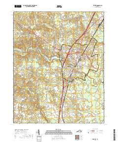
2019 Map of Emporia
USGS Topo · Published 2019About this map
The Meherrin River winds through the heart of Emporia, serving as a central geographic anchor for this southern Virginia hub. The map illustrates the town's expansion across the river into North Emporia, anchored by the Greensville County Courthouse. As a regional center for education and civic life, the area includes the Southside Virginia Community College - Wrenn Campus and residential developments like Washington Park and Westover Hills.
Find a feature on this map
113 named features on this map. Tap any name to fly to it.
Don’t see what you’re looking for? This feature index may not catch every label — zoom into the map to look around manually.
Map Details
Editions of this 2019 Emporia Map
This is the sole edition of this map. No revisions or reprints were ever made.
Other maps of this area

1919 · Jarratt
USGS Topo · 1:62,500

1919 · Mc Kenney
USGS Topo · 1:48,000

1919 · Emporia
USGS Topo · 1:62,500

1919 · Arringdale
USGS Topo · 1:48,000

1920 · Arringdale
USGS Topo · 1:62,500

1921 · Mc Kenney
USGS Topo · 1:62,500

1942 · Arringdale
USGS Topo · 1:62,500

1942 · Emporia
USGS Topo · 1:62,500

1943 · Mc Kenney
USGS Topo · 1:62,500

1951 · Jarratt
USGS Topo · 1:62,500