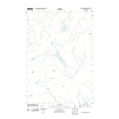
2011 Map of Enchanted Pond
USGS Topo · Published 2011About this map
Enchanted Pond and the surrounding peaks of Somerset County define this high-altitude landscape in the early 21st century. The map reveals a network of remote timber and access roads, including Spencer Rd and Lewis and Clark Rd, which navigate the terrain between Coburn Mountain and Shutdown Mountain. Isolated outposts like Grace Pond Camp and Bulldog Camps provide the only significant human footprints in a wilderness dominated by water and rock. This geography is characterized by an intricate drainage system where Horse Brook and Stony Brook feed numerous smaller basins such as McKenney Ponds and Little Gordon Pond. The distribution of these water bodies and named peaks like Granny Cap reflects a region primarily shaped by recreational use and the forestry industry, where seasonal camps and narrow lanes like Slim Haggle Rd offer the primary means of traversal.
Find a feature on this map
52 named features on this map. Tap any name to fly to it.
Don’t see what you’re looking for? This feature index may not catch every label — zoom into the map to look around manually.
Map Details
Editions of this 2011 Enchanted Pond Map
This is the sole edition of this map. No revisions or reprints were ever made.
Other maps of this area

1922 · Long Pond
USGS Topo · 1:62,500

1923 · Attean
USGS Topo · 1:62,500

1924 · Long Pond
USGS Topo · 1:62,500

1925 · Pierce Pond
USGS Topo · 1:48,000

1925 · Attean
USGS Topo · 1:62,500

1927 · Pierce Pond
USGS Topo · 1:62,500

1928 · Spencer
USGS Topo · 1:48,000

1932 · Spencer
USGS Topo · 1:62,500

1944 · Long Pond
USGS Topo · 1:62,500

1944 · Pierce Pond
USGS Topo · 1:62,500
Featured Places
- T3 R5 BKP WKR, ME
- Upper Enchanted Township, ME
- Johnson Mountain Township, ME
- Lower Enchanted Township, ME
- Bradstreet Township, ME