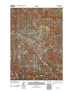
2011 Map of Encina
USGS Topo · Published 2011About this map
Encina and Pleasant Valley anchor this Baker County corridor, where modern infrastructure follows the historical path of Old Hwy 30. The landscape is defined by the drainage systems of the Virtue Hills, with numerous seasonal and perennial watercourses like Quartz Creek, Dry Creek, and Dogtown Creek carving through the terrain. A notable cultural landmark is the Pleasant Valley Cemetery, situated near the confluence of Alder Creek and its tributaries. The map details a complex network of rural access roads, including Dry Creek Rd and Ebell Creek Rd, which provide a clear picture of the modern land use and historical transit patterns across this high-desert environment. The presence of Alder Creek Spring and named features like Dry Gulch highlight the importance of water management in this arid stretch of eastern Oregon.
Find a feature on this map
21 named features on this map. Tap any name to fly to it.
Don’t see what you’re looking for? This feature index may not catch every label — zoom into the map to look around manually.
Map Details
Editions of this 2011 Encina Map
This is the sole edition of this map. No revisions or reprints were ever made.
Other maps of this area

1901 · Baker City
USGS Topo · 1:125,000

1955 · Baker
USGS Topo · 1:250,000

1959 · Baker
USGS Topo · 1:250,000

1967 · Virtue Flat
USGS Topo · 1:24,000

1967 · Encina
USGS Topo · 1:24,000

1967 · Baker
USGS Topo · 1:24,000
1967 · Keating
USGS Topo · 1:24,000

1967 · French Gulch
USGS Topo · 1:24,000

1967 · Dooley Mtn
USGS Topo · 1:24,000

1967 · Lost Basin
USGS Topo · 1:24,000