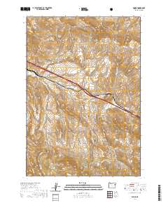
2020 Map of Encina
USGS Topo · Published 2020About this map
Pleasant Valley serves as the central hub of this Baker County landscape, where the legacy of early travel is evident along the corridor of Old US Hwy 30. The terrain is defined by the Virtue Hills to the north and the northern reaches of the Whitman National Forest to the south. This area is etched by numerous drainage systems including Baiseley Cr, Dogtown Cr, and Quartz Cr, which flow through the high-desert canyons.
Find a feature on this map
33 named features on this map. Tap any name to fly to it.
Don’t see what you’re looking for? This feature index may not catch every label — zoom into the map to look around manually.
Map Details
Editions of this 2020 Encina Map
This is the sole edition of this map. No revisions or reprints were ever made.
Other maps of this area

1901 · Baker City
USGS Topo · 1:125,000

1955 · Baker
USGS Topo · 1:250,000

1959 · Baker
USGS Topo · 1:250,000

1967 · Virtue Flat
USGS Topo · 1:24,000

1967 · Encina
USGS Topo · 1:24,000

1967 · Baker
USGS Topo · 1:24,000
1967 · Keating
USGS Topo · 1:24,000

1967 · French Gulch
USGS Topo · 1:24,000

1967 · Dooley Mtn
USGS Topo · 1:24,000

1967 · Lost Basin
USGS Topo · 1:24,000