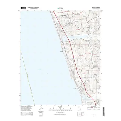
2015 Map of Encinitas
USGS Topo · Published 2015About this map
The coastal communities of Encinitas and Leucadia are presented here during a period of significant suburban density, as the Pacific shoreline meets a complex network of residential development. This 2015 study by the U.S. Geological Survey illustrates how the landscape is segmented by major lagoons, specifically Batiquitos Lagoon to the north and San Elijo Lagoon to the south. These natural features, along with Canyon de las Encinas and Lux Canyon, provide distinct breaks in the urban corridor that connects Carlsbad and Solana Beach.
Find a feature on this map
199 named features on this map. Tap any name to fly to it.
Don’t see what you’re looking for? This feature index may not catch every label — zoom into the map to look around manually.
Map Details
Editions of this 2015 Encinitas Map
This is the sole edition of this map. No revisions or reprints were ever made.
Other maps of this area

1893 · Oceanside
USGS Topo · 1:62,500

1893 · Escondido
USGS Topo · 1:62,500

1898 · Oceanside
USGS Topo · 1:62,500

1901 · Escondido
USGS Topo · 1:62,500

1901 · Oceanside
USGS Topo · 1:62,500

1901 · San Luis Rey
USGS Topo · 1:125,000

1903 · La Jolla
USGS Topo · 1:62,500

1904 · Southern California Sheet No. 2
USGS Topo · 1:250,000

1930 · La Jolla
USGS Topo · 1:62,500
1942 · Oceanside
USGS Topo · 1:62,500