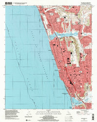
2022 Map of Encinitas
USGS Topo · Published 2022About this map
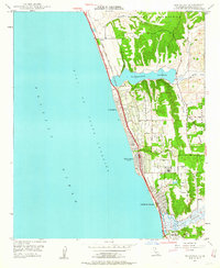
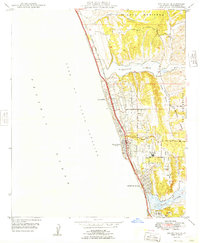
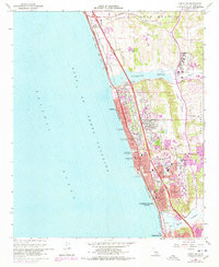
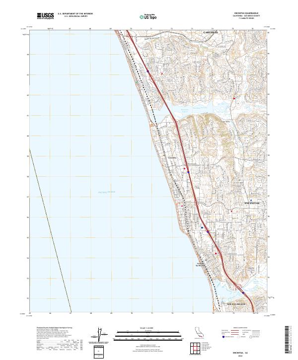
Coastal lagoons and residential development define the corridor between Carlsbad and Solana Beach along the San Diego County shoreline. The landscape is marked by tidal basins like Batiquitos Lagoon and San Elijo Lagoon, which interrupt the urban grid where San Marcos Creek and Escondido Creek meet the Pacific Ocean. This modern survey reveals the dense neighborhood networks of Encinitas, Leucadia, and Cardiff-by-the-Sea, oriented around thoroughfares such as Leucadia Blvd and the historic route of the At&Sf Rr. Higher education is represented by the Mira Costa College San Elijo Campus situated near Lux Canyon, while the northern portion of the map is dominated by the industrial and suburban expansion near Canyon de las Encinas. The terrain alternates between coastal bluffs and protected valleys like Green Valley, reflecting the complex topography of the Southern California coast.
Find a feature on this map
56 named features on this map. Tap any name to fly to it.
Don’t see what you’re looking for? This feature index may not catch every label — zoom into the map to look around manually.
Map Details
Editions of this 2022 Encinitas Map
This is the sole edition of this map. No revisions or reprints were ever made.
Historical Maps of Carlsbad Through Time
8 maps found