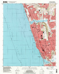
1997 Map of Encinitas
USGS Topo · Published 2001About this map
The coastal shelf of the Gulf of Santa Catalina reveals a landscape defined by dramatic lagoons and suburban expansion at the close of the twentieth century. Between the southern reaches of Carlsbad and the northern edge of Solana Beach, the terrain is punctuated by significant ecological features like Batiquitos Lagoon and San Elijo Lagoon, which dictate the local infrastructure. The community of Encinitas serves as the central hub, where the historic Santa Fe rail line parallels the coast, stitching together the neighborhoods of Leucadia and Cardiff-by-the-Sea. Civic development is evident through the placement of the Library and numerous educational centers like San Dieguito Union High Sch and Oak Crest Jr High Sch. The map also captures the local emphasis on horticulture and recreation, notably at the Quail Park Botanical Garden and Moonlight State Beach.
Find a feature on this map
43 named features on this map. Tap any name to fly to it.
Don’t see what you’re looking for? This feature index may not catch every label — zoom into the map to look around manually.
Map Details
Editions of this 1997 Encinitas Map
This is the sole edition of this map. No revisions or reprints were ever made.
Other maps of this area

1893 · Oceanside
USGS Topo · 1:62,500

1893 · Escondido
USGS Topo · 1:62,500

1898 · Oceanside
USGS Topo · 1:62,500

1901 · Escondido
USGS Topo · 1:62,500

1901 · Oceanside
USGS Topo · 1:62,500

1901 · San Luis Rey
USGS Topo · 1:125,000

1903 · La Jolla
USGS Topo · 1:62,500

1904 · Southern California Sheet No. 2
USGS Topo · 1:250,000

1930 · La Jolla
USGS Topo · 1:62,500
1942 · Oceanside
USGS Topo · 1:62,500