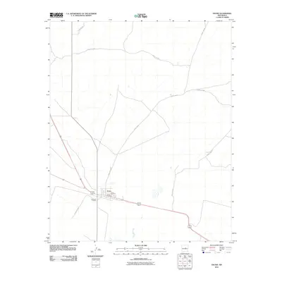
2010 Map of Encino
USGS Topo · Published 2010About this map
Encino sits as a central hub in the high plains of Torrance County, where the convergence of major regional thoroughfares and rural county routes defines the local landscape. This 2010 survey illustrates the organized layout of the settlement, anchored by the Encino Post Office. The social and historical fabric of the community is evidenced by the presence of two distinct burial grounds, Encino Cemetery and Guadalupe Cemetery, which serve as vital points of reference for genealogical research in this part of New Mexico. Beyond the town center, the map details an expansive network of rural roads such as County Rd-C077 and County Rd-C049, which provide access to the surrounding rangeland and intermittent drainage patterns characteristic of this arid environment.
Find a feature on this map
10 named features on this map. Tap any name to fly to it.
Don’t see what you’re looking for? This feature index may not catch every label — zoom into the map to look around manually.
Map Details
Editions of this 2010 Encino Map
This is the sole edition of this map. No revisions or reprints were ever made.
Other maps of this area

1954 · Fort Sumner
USGS Topo · 1:250,000

1958 · Fort Sumner
USGS Topo · 1:250,000

1978 · North Lucy
USGS Topo · 1:24,000

1978 · Santa Barbara Lake
USGS Topo · 1:24,000

1978 · Tejon
USGS Topo · 1:24,000

1978 · Santo Nino Canyon
USGS Topo · 1:24,000

1978 · Encino
USGS Topo · 1:24,000

1978 · Negra SE
USGS Topo · 1:24,000

1978 · Negra
USGS Topo · 1:24,000

1978 · Dunlap Ranch
USGS Topo · 1:24,000