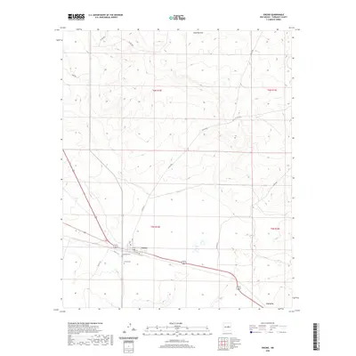
2020 Map of Encino
USGS Topo · Published 2020About this map
Encino serves as the primary hub of this high plains landscape, situated at the junction of major transit corridors where Pinon St and Railroad Ave meet. The settlement’s geography is defined by its proximity to several localized landmarks, including the nearby Encino Cem and Guadalupe Cem. The terrain to the north is marked by the winding path of Amarillo Draw, which cuts through the higher elevations of Torrance County. To the southeast, the small settlement of Carnero sits along the roadway, illustrating the sparse but deliberate distribution of communities in this part of New Mexico. Detailed surveying by the U.S. Geological Survey captures a network of county roads such as Perez Rd and Co Rd C016 that link remote ranching or agricultural tracts across the townships of t6n r14e and t5n r14e.
Find a feature on this map
20 named features on this map. Tap any name to fly to it.
Don’t see what you’re looking for? This feature index may not catch every label — zoom into the map to look around manually.
Map Details
Editions of this 2020 Encino Map
This is the sole edition of this map. No revisions or reprints were ever made.
Other maps of this area

1954 · Fort Sumner
USGS Topo · 1:250,000

1958 · Fort Sumner
USGS Topo · 1:250,000

1978 · North Lucy
USGS Topo · 1:24,000

1978 · Santa Barbara Lake
USGS Topo · 1:24,000

1978 · Tejon
USGS Topo · 1:24,000

1978 · Santo Nino Canyon
USGS Topo · 1:24,000

1978 · Encino
USGS Topo · 1:24,000

1978 · Negra SE
USGS Topo · 1:24,000

1978 · Negra
USGS Topo · 1:24,000

1978 · Dunlap Ranch
USGS Topo · 1:24,000