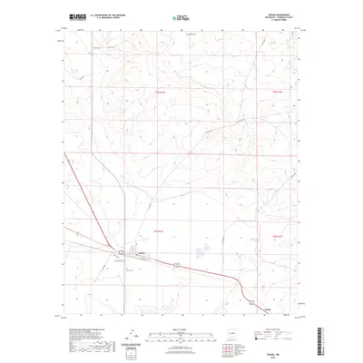
2023 Map of Encino
USGS Topo · Published 2023About this map
Encino serves as the primary hub of this high-plains landscape in Torrance County, situated where the path of the railroad intersects major regional thoroughfares. The town layout is anchored by Railroad Ave, reflecting its historical development alongside the rail line. Just outside the main settlement, the Encino Cem and Guadalupe Cem provide significant points of interest for genealogists tracing the legacy of local families in this part of New Mexico. The surrounding terrain is defined by the intermittent drainage of Amarillo Draw to the north and a network of rural routes such as Perez Rd and Co Rd C036. To the southeast, the location of Carnero sits near the junction of modern highways, illustrating the shift in transportation patterns from early rail-side towns to car-oriented development.
Find a feature on this map
18 named features on this map. Tap any name to fly to it.
Don’t see what you’re looking for? This feature index may not catch every label — zoom into the map to look around manually.
Map Details
Editions of this 2023 Encino Map
This is the sole edition of this map. No revisions or reprints were ever made.
Other maps of this area

1954 · Fort Sumner
USGS Topo · 1:250,000

1958 · Fort Sumner
USGS Topo · 1:250,000

1978 · North Lucy
USGS Topo · 1:24,000

1978 · Santa Barbara Lake
USGS Topo · 1:24,000

1978 · Tejon
USGS Topo · 1:24,000

1978 · Santo Nino Canyon
USGS Topo · 1:24,000

1978 · Encino
USGS Topo · 1:24,000

1978 · Negra SE
USGS Topo · 1:24,000

1978 · Negra
USGS Topo · 1:24,000

1978 · Dunlap Ranch
USGS Topo · 1:24,000