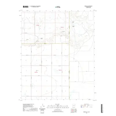
2020 Map of Endee Hill
USGS Topo · Published 2020About this map
Mitchell Cem serves as a significant genealogical marker in this high plains landscape where the border between Quay and Curry County meets the Texas state line. The terrain is defined by dramatic erosional features like Simmons Canyon and Salt Well Canyon, which carve into the plateau near the New Mexico-Texas boundary. Small concentrations of activity appear at Purcell and near the distinct elevations of Endee Hill and Rusk Hill.
Find a feature on this map
35 named features on this map. Tap any name to fly to it.
Don’t see what you’re looking for? This feature index may not catch every label — zoom into the map to look around manually.
Map Details
Editions of this 2020 Endee Hill Map
This is the sole edition of this map. No revisions or reprints were ever made.
Other maps of this area

1954 · Tucumcari
USGS Topo · 1:250,000

1954 · Clovis
USGS Topo · 1:250,000

1958 · Clovis
USGS Topo · 1:250,000

1958 · Tucumcari
USGS Topo · 1:250,000

1966 · Sand Point
USGS Topo · 1:24,000

1968 · Rock Camp
USGS Topo · 1:24,000

1968 · Riley Camp
USGS Topo · 1:24,000

1971 · Mustang Lake
USGS Topo · 1:24,000

1971 · Garcia Lake
USGS Topo · 1:24,000

1971 · Day Canyon
USGS Topo · 1:24,000